Basins
Colorado (Upper) basin
Reservoir storage across Arizona / Utah
Last updated Jul 8, 2026
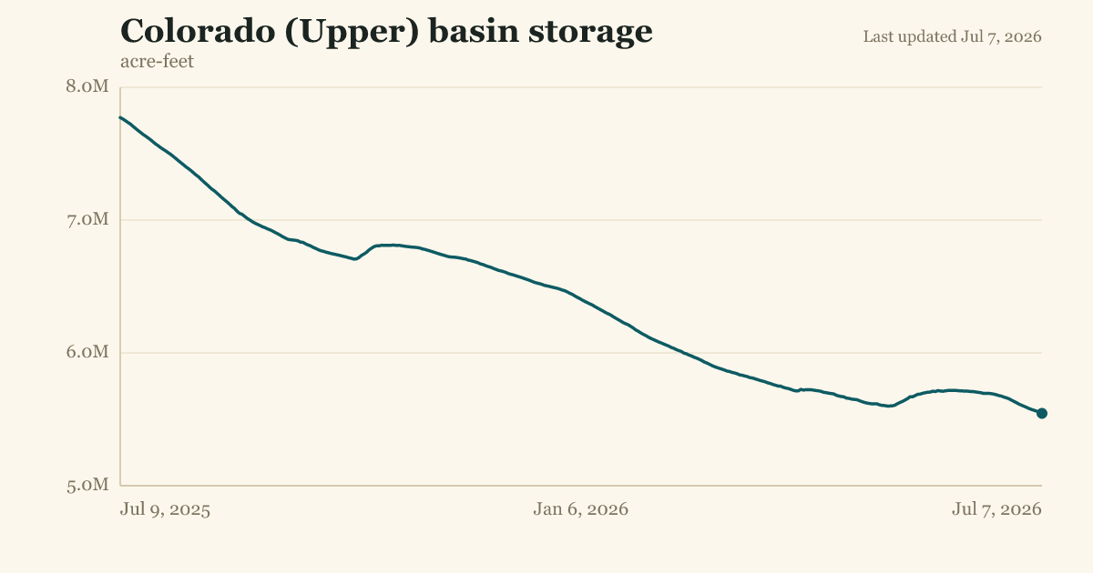
1 tracked reservoir holding 5.54M af combined.
I don't have enough context to create this note accurately. This looks like it's for a water resource tracking dashboard, but I'm missing some key information:
- What's the purpose of this tracker? (e.g., drought monitoring, water supply planning, historical record-keeping)
- Who's the audience? (internal ops, public dashboard, investor reporting)
- What thresholds or context matter? (e.g., "Lake Powell is at X% of capacity, which is [normal/concerning/record]")
- Is there historical context? (e.g., "down from X last year" or "lowest since Y")
- What action should someone take with this data? (monitor trend, trigger alerts, inform decisions)
Quick example of what I could write:
- "Lake Powell, the primary water storage reservoir serving the Lower Colorado Basin, currently holds 5.54M acre-feet as of July 7, 2026. This page tracks real-time storage levels to support water allocation planning across Arizona and Utah."
But I'd rather ask: Is this for a personal water/climate dashboard, a business water-rights tracker, or something else? That'll help me write a note that actually fits your use case.